Mark Richards
Hadrian's Wall Path
- National Trail: Described west-east and east-west
ISBN: 978-1-786-31150-4
240 Seiten | € 27.90
Buch [Taschenbuch]
Erscheinungsdatum:
12.10.2023
Roman
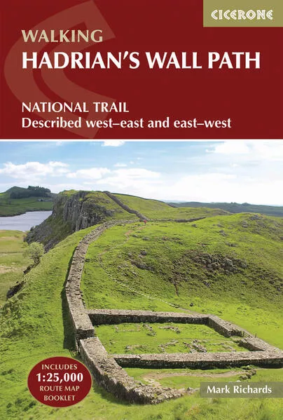
Mark Richards
Hadrian's Wall Path
National Trail: Described west-east and east-west
4.8/5.00 bei 13 Reviews - aus dem Web
A guidebook to walking the Hadrian's Wall Path National Trail between Bowness-on-Solway in Cumbria and Wallsend, Newcastle. Covering 135km (84 miles), this historic route takes around 10 days to hike. Suitable for beginners, it nevertheless requires a reasonable level of fitness to undertake as a multi-day walk.
The route is described in 10 stages between 8 and 16km (5–10 miles) in length and in both directions, west–east and east–west. An optional 2-stage extension through Newcastle to South Shields on the east coast is also provided.
- Contains step-by-step description of the route alongside 1:100,000 OS maps
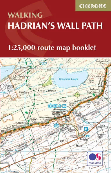
- Includes a separate map booklet containing OS 1:25,000 mapping and route line
- Handy route summary tables, alternative walking schedules and accommodation listings help you plan your itinerary
- Packed with historical detail, as well as maps marking locations of Roman milecastles and other archaeological sites on and near the wall
- Public transport by stage is listed for those wanting to break the trail into shorter sections
Unterstütze den lokalen Buchhandel
Nutze die PLZ-Suche um einen Buchhändler in Deiner Nähe zu finden.
Bestelle dieses Buch im Internet
| Veröffentlichung: | 12.10.2023 |
| Höhe/Breite/Gewicht | H 17,2 cm / B 11,6 cm / 310 g |
| Seiten | 240 |
| Art des Mediums | Buch [Taschenbuch] |
| Preis DE | EUR 27.90 |
| Preis AT | EUR 27.90 |
| Reihe | Cicerone guidebooks |
| ISBN-13 | 978-1-786-31150-4 |
| ISBN-10 | 178631150X |

Diesen Artikel teilen
0 Kommentar zu diesem Buch


Leserunde
Leserunde zu Kiss the Enemy!
Bewerbungsfrist bis zum: 08.10.2024